-
 ENVIRONMENTAL GEOPHYSICS
We use near surface Geophysical Methods
to describe the earth's shallow subsurface -
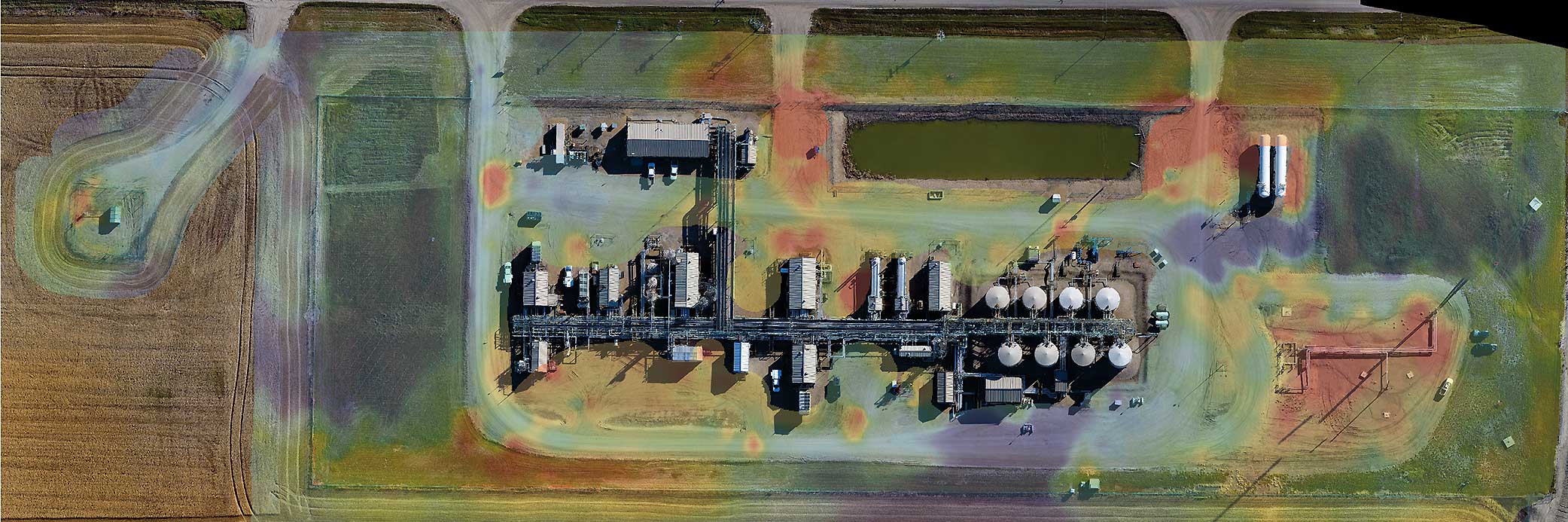 DRONE AND SATELLITE IMAGING
Advanced imaging technology allows
characterization of surface features in new ways -
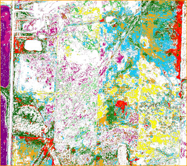
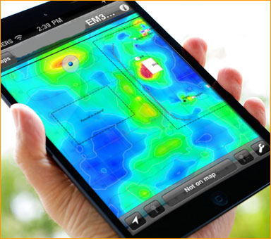
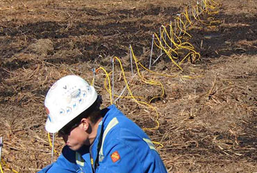
 ELECTROMAGNETIC OR EM SURVEYS
Measure soil conductivity to determine
extent of impact related to industrial activity
- Professional Geophysical Services
- 20+ Years of Excellence
- +1 403-277-4664
- info@aksgeoscience.com
Quick Response
We pride ourselves on our ability to mobilize quickly and will do everything possible to accommodate your schedule.
Dedicated Team
We are professional geoscientists and have completed thousands of geophysical investigations over the past 20+ years.
Safety First
Safety is our priority and are COR certified in compliance with Occupational Health and Safety Regulations.
Quality Assurance
All aspects of our operations are regularly reviewed in-house to ensure we preserve the highest possible quality.
Featured Services
We offer a number of remote sensing methods to help characterize your site. Let us work with you to determine which methods are best-suited to meet your project goals.

An EM Survey is routinely used during environmental investigations to measure ground conductivity.
Electrical resistivity tomography provides an image in cross-sectional format.

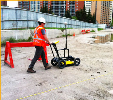
Ground penetrating radar is a shallow looking technique that maps interfaces such as bedrock.

Satellite imaging along with multi-spectral analysis can be used to identify subtle surface variations.

Our drones can monitor your event in real time and in high resolution.
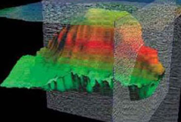
We can combine EM and ERT data sets to generate a volume of an elevated conductivity zone.